
Hiking Spy Rock
**UPDATE SEPTEMBER 2017- THE MAIN TRAIL TO THE SUMMIT HAS BEEN CLOSED BY LOCAL LANDOWNERS DUE TO RUDE HIKERS, THEFTS AND HIKERS DISRESPECTING PRIVATE PROPERTY. A NEW TRAIL IS CURRENTLY BEING BLAZED THAT IS A BIT LONGER. PLEASE RESPECT PRIVATE PROPERTY AND OTHER'S BELONGINGS WHILE ON THE TRAIL, DON'T SUCK AND RUIN IT FOR EVERYONE ELSE.**


My good friend is about to take off to Costa Rica for a month so to get her back into her hiking groove, another friend and I decided to take her hiking so she could break in some of her new gear. We decided to head down south of Harrisonburg to hike Spy Rock. The drive coming up to the trailhead was fun to say the least; the roads were winding and the scenery was breathtaking.
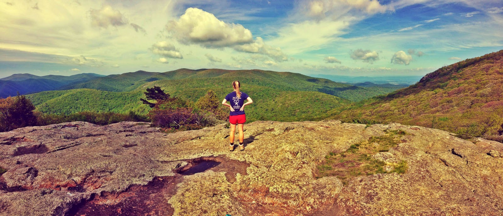
The beginning part of the hike was pretty uneventful and started on a fire road. After about a mile, the fire road intersects the Appalachian Trail, and about half a mile after that the side trail for Spy Rock intersects the AT. Once we turned onto the AT, the terrain became more rocky and exciting. When we got to the “outlook” we were confused because all we saw were a few camp sites and then a HUGE boulder. We soon discovered that there is a bit of a scramble (gotta climb the rocks) to get to the actual outlook, so be prepared! But once we got on top of the boulder the view was absolutely stunning. The day was perfect and cool and it was very windy on top of the rock.
If I had known that the outlook has such a nice little campsite I would’ve planned to do an overnight trip.
The only two negative things I have to say about this hike are: 1. the last little stretch of road approaching the parking lot is BUMPY and if you have a small car be super careful not to bottom out or pop a tire! 2. the bugs were almost unbearable; about every few steps we were squashing mosquitoes and didn’t come prepared with bug spray (big mistake on our part). Otherwise the hike was enjoyable, it really got our hearts pumping with the steady incline. I highly recommend this hike :)
Get outdoors!
Jess